ANCIENT LEGACY
DRAGON SONGS OF FIRE & ICE
Those Who Unite Heaven & Earth

Fire & Ice
WAS IT A COMET?
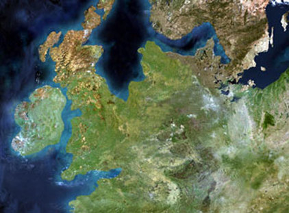
Legendary dragon tales abound in stories of fire and ice. In those days nothing was known about the nature of cometary impacts or debris that could leave scorched earth, set the world ablaze, or create massive tsunamis. Meanwhile, the glacial modulations were still in effect, creating wild swings in weather, also affected by volcanic activity.
A fabled jewel is said to have fallen from Lucifer’s crown during the war in Heaven. In the occult it is used as a symbol of enlightenment - of the descent of divine light form the mind of God into the mind of Man. As such it symbolizes Venus, the Morning Star, as well as the Luciferian doctrine of the initiates, the secret knowledge which men are not allowed, and which Lucifer’s angels were cast from Heaven for sharing with man. In Freemasonry, this is symbolized as the Blazing Star, which is often depicted as falling from Heaven. As Albert Pike writes in Morals and Dogma, The Blazing Star has been regarded as an emblem of Omniscience, or the All-Seeing Eye, which to the ancients was the Sun. Masons also represent the Lapsit Exillis as the Stone that was rejected - the secret cornerstone of Solomon’s Temple which symbolizes the core of their teachings.
For us, the Lapsit Exillis is also a cornerstone, for it is the solid rock upon which our ideals stand, and upon which we have built our work. For us, the Stone that fell from Heaven provides the foundation of our fraternity, and is certainly a jewel most valued. The stone that fell to earth was an emerald that adorned Lucifer’s forehead. It was cut into the shape of a bowl by a faithful angel, and thus the Grail was born. It was given to Adam before he was expelled from the Garden of Eden. Seth, Adam’s son, having temporarily returned to the earthly paradise, took the Grail along with him. Other people transported the Grail to Montsegur, a fortress in the Pyrenees, which Lucifer’s armies besieged in order to get the Grail back and put it into their leader’s crown, out of which it had fallen; but the Grail was allegedly saved by knights who hid it within a mountain. - Julius Evola, The Mystery of the Grail
Myths encode impressive and hard-to-account-for events. Myths are analogical stories created by highly skilled and trained cultural knowledge specialists (such as priests or historians) using supernatural images in order to explain otherwise inexplicable natural events or processes. The priest doesn't just invent his story of the sun being eaten by a giant dog; he comes up with it as a means of explaining an eclipse that has his people scared out of their wits.
Masse began examining both the mythology and the archaeology of areas around the sites where asteroids or comets were known or suspected to have fallen to earth during the Quaternary, and especially during the last 11,000 years, known as the Holocene. Science is aware of at least twenty-seven known Quaternary impact sites, marked by craters and often the remnants of meteoritic iron and melted stone. Other impacts are known from the presence of glassy melts and tektites created by an impact or explosion in the atmosphere (an airburst). Virtually all are on land, where scientists have been able to record, study, and date them using radiocarbon age determination and other geophysical methods. Since the Earth's land masses make up only about a third of the planet's surface, it follows that in the last 2.6 million years there have been roughly 75 comet/asteroid strikes potentially big enough to leave physical signs on the ground, with even larger numbers striking the oceans. Few of these were big enough to have wiped out a civilization had one existed in the neighborhood, but each one could have killed a lot of our ancestors.
18,000 years ago, sea level was about 120m below the present;
the late glacial sea-level rise associated with melting of the continental ice sheets reached
the modern level about 5,000 to 6,000 years ago.
the late glacial sea-level rise associated with melting of the continental ice sheets reached
the modern level about 5,000 to 6,000 years ago.
This has two very important consequences for archaeological interpretation. First, although this maximum lowering was relatively short-lived, persisting for perhaps 5,000 years, for most of the glacial period sea level was at least 50–60m below present. In fact extremes of sea-level variation, whether very high or very low, are relatively short-lived episodes on a Pleistocene time scale. The –60m level is closer to the norm, but still means that most of human existence before 6,000 years ago has been played out in a world of sea levels much lower than the present. Isostatic and rheostatic modelling of crustal deformation under varying loads of ice and water suggests regional and local variation in this pattern, especially close to the margin of the continental ice sheets (Lambeck 1995). But the implication is clear. More or less extensive tracts of the continental shelf which were inhabited sank beneath the waves.
Homo georgicus, which lived roughly 1.8 million years ago in Georgia, is the earliest hominid to have been discovered in Europe.[24] Other hominid remains, dating back roughly 1 million years, have been discovered in Atapuerca, Spain.[25]Neanderthal man (named for the Neander Valley in Germany)
appeared in Europe 150,000 years ago and disappeared from the fossil
record about 30,000 years ago. The Neanderthals were supplanted by
modern humans (Cro-Magnons), who appeared in Europe around 40,000 years ago.[26]
The European Neolithic period—marked by the cultivation of crops and the raising of livestock, increased numbers of settlements and the widespread use of pottery—began around 7000 BC in Greece and the Balkans, probably influenced by earlier farming practices in Anatolia and the Near East. It spread from South Eastern Europe along the valleys of the Danube and the Rhine (Linear Pottery culture) and along the Mediterranean coast (Cardial culture). Between 4500 and 3000 BC, these central European neolithic cultures developed further to the west and the north, transmitting newly acquired skills in producing copper artefacts. In Western Europe the Neolithic period was characterized not by large agricultural settlements but by field monuments, such as causewayed enclosures, burial mounds and megalithic tombs.[27] The Corded ware cultural horizon flourished at the transition from the Neolithic to the Chalcolithic. During this period giant megalithic monuments, such as the Megalithic Temples of Malta and Stonehenge, were constructed throughout Western and Southern Europe.[28][29] The European Bronze Age began in the late 3rd millennium BC with the Beaker culture.
The European Iron Age began around 800 BC, with the Hallstatt culture. Iron Age colonisation by the Phoenicians gave rise to early Mediterranean cities. Early Iron Age Italy and Greece from around the 8th century BC gradually gave rise to historical Classical Antiquity. http://en.wikipedia.org/wiki/Europe
Fertile Darkness, Iona Miller
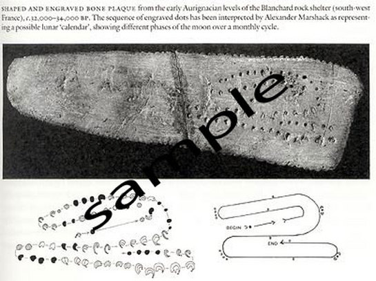
The
evidence of the veneration of snakes in Europe is also accompanied with
evidence of the observation, and a concomitant committing of these
observations to a permanent record, of the movement of celestial
objects. In the above instance it is the phases of the moon. It is no
coincidence that the passage of the moon is serpentine. This
engraved bone dates to c.32000-34000 BC. Alexander Marshack argues that
it is a calendar recording the moon's monthly cycle.
A
complete explanation which includes lunar nodes calculated to see
whether the patterns on the bone conform to the lunar cycle is given by
Marshack in his book, pp. 44-50.
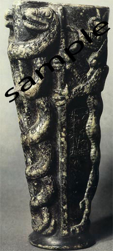
Lagash vase, "the dragon mushussu stone vase" dates to c. 2100BC.
Image source: The Art of the Ancient Near East
by Pierre Amiet, Naomi Noble Richard
ISBN: 0810906384
(Amazon link). "In the Louvre, there is a famous green steatite vase carved for king Gudea of Lagash (dated variously 2200& 2025 BCE),
dedicated by its inscription to Ningizzida, "Lord of the Tree of Truth" which bears a relief of serpents twined round a staff"
( http://www.reference.com/browse/wiki/Serpent )

No current reversal at 10,000 B.P. in the Strait of Gibraltar
Liselotte Diester-Haassa
aGeologisch-Paläontologisches Institut der Universität Kiel, Kiel Germany
Accepted 15 May 1973. Available online 4 April 2003.
Abstract - Two cores taken west of Gibraltar within the region of recent current influence of Mediterranean bottom outflow, have been studied. A coarse-fraction analysis has been made in order to see if current influence occurs in the lutitic sediments and whether there has been a change in current systems.
In most parts of the cores, the curves of median diameters of planktonic and benthonic foraminifers are parallel. The sediments are sorted due to the Mediterranean bottom outflow, which reduces sedimentation of small sand-sized particles. In some core sections there is no sorting. Sorted and non-sorted layers are contemporaneous in the two cores. Current reversal in Holocene and Late Pleistocene, from 10,000 to 17,000–21,000 years B.P., is most unlikely. The two non-sorted layers in the lower core sections (17,000–21,000 to 34,000–46,000 years B.P.) may have been produced by current reversals or by a northerly shift of the Mediterranean bottom outflow in the Bay of Cadiz.
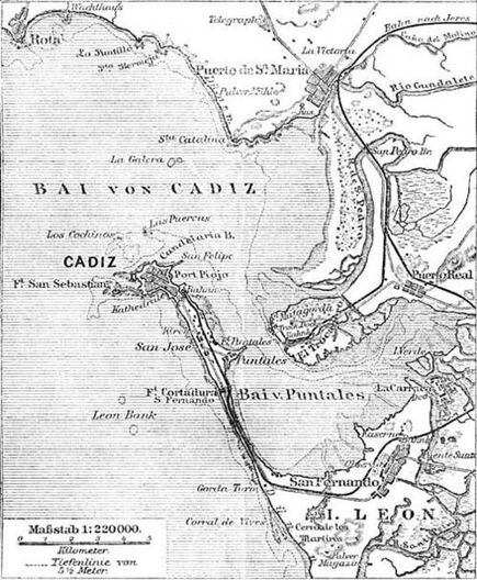
ATLANTIS in Southern Spain?
The modern port city of Cadiz (originally called Gadir or Gardes) in the
Andalucia region of Spain was a Phoenician colony of Tyre founded at
least by the 9th century BC, and perhaps as early as the 11th. The Rio
Tinto silver mines appear to have been the driving force for Phoenician
occupation of the region. Carthage controlled southern Spain in the 5th
through 2nd centuries BC, and in 206 BC, the Romans took the city and
established a fort there. Most recently, at the mouth of the
Guadalquivir River, the German historian Rainer Kühne believes there are
ruins in the muddy area of Marisma de Hinojos that may have inspired
Plato's Atlantis story.
(ANSAmed) - MADRID, JULY 17 - A group of Spanish researchers is preparing to begin excavations in the national park of Donana, in Andalusia, after having confirmed thanks to satellite photos the existence of great artificial structures which could belong to the mysterious and ancient city of Tartessos, which modern studies and new readings of the Greek authors believe to have identified with Plato's Atlantis. The group, led by archaeologists Sebastian Celestino and Juan Jose Villarias Robles of the Supreme Council of Scientific Research (CSIC), has carried out long research beginning with the hypothesis formulated in the 1920's by Adolf Schulten, the discoverer of Numancia, according to whom Tartessos, "the first sea empire of the West", set up one thousand years before Christ, rose at the mouth of the Guadalquivir river between Huelva and Cadiz. And, the German archaeologist claimed, it was the model whom Plato used to describe Atlantis. Schulten's insights, taken and developed by the philological and historical studies of Spanish Georgeos Diaz-Montexano, were confirmed in the past years by satellite photos which revealed in Donana vast artificial structures. Two Germans, Werner Wickboldt and physicist Rainer Kuehne, relaunched the theory of Atlantis-Tartessos in 2004, beginning from these results. "The photographs showed two big rectangular structures which could have been the temples of Poseidon and Cleito described by Plato. And big concentric lines similar to the canals which according to the philosopher surrounded the city of Atlantis," Kuehne told ANSA. Starting from the hypotheses formulated by him, he explained, the CSIC group, which is in contact with him, has carried out new air surveillance which not only confirmed the rectangular and circular structures but also discovered new and triangular ones. More certainty will be needed for excavation on large scale in the very protected Natural Park, and the archaeologists set about making a preliminary ten metres deep drilling in the area of Las Marismas (swamps). The reasons to suppose that Atlantis is in Andalusia come from the dialogues 'Timaeus' and 'Critias', where Plato indicated that the Atlantis Empire spread along the whole southern-western Iberian coast to Gades, current Cadiz, over the Pillars of Hercules, namely the Strait of Gibraltar. The capital of Atlantis rose on an island rounded by a triple water circle and was connected to the sea through a large artificial channel: like Tartessos, at the centre of an archipelago in the estuary of Guadalquivir. The group of researchers is very cautious. "We are convinced that there are ruins of settlements, despite the fact that we still do not know from which epoch", Celestino limited himself to telling El Pais. The geologist of the group, Antonio Rodriguez, suggests a tsunami because of the enlargement of Donana, until now considered flooded, and therefore maybe for the end of Tartessos, until now explained with the destruction by the Carthaginians. Rodriguez indicates that the results from the geological examinations suggest a tsunami happened between 1500 B.C. and II century A.D. (ANSAmed). http://www.ansamed.info/en/spain/news/ME03.YAM19595.html
Recent aerial photos of marshy Andalusian parkland show a 3,000-year-old lost city that may have links with the legendary city of Atlantis, say archaeologists from Spain's Higher Council for Scientific Study (CSIC).
Archaeologists trace the settlement in Donaña National Park back to the civilization of Tartessos, an extravagantly wealthy civilization which flourished from 11th – 6th century BC, predating the Phoenicians in the southern Iberian peninsula. Tartessos, ruled by a legendary king Arganthonios, dominated lucrative gold and silver trade routes with the Greeks and Pheonicians during the Bronze Age.
The aerial images of broad circular and rectangular forms pinpoint the settlement at an area where the Guadalquiver river flows into the Atlantic. Archaeologists have found evidence of Tartessian civilization on the other side of the river; as Sebastian Celestino, the archaeologist leading the project told the newspaper El Pais: "If they existed on the other side, they must also have been here (in Donaña).” This location of Tartessos is supported in literary accounts by Greek geographers such as Strabo.
The buzz around this find is particularly great, because Tartessos has been linked to the legendary city of Atlantis. So the story goes: sometime around the 6th century, the Tartessos civilization vanished. Some say it was destroyed by the Carthaginians, others say it was refounded elsewhere under the name Carpia. Others, though, say Tartessos may have been wiped out by a tsunami, much like the lost, opulent city of Atlantis, of which Plato writes: "In a single day and night … the island … disappeared into the depths of the sea." Tartessos was certainly renowned for its wealth and the geography lines up perfectly (Plato wrote that Atlantis was beyond the straits of Gibraltar): could Tartessos be Atlantis?
While Celestino wants to avoid speculation, he seems convinced that Tartessos demise was indeed the result of a tsunami: "There were earthquakes and one of them caused a tsunami that razed everything and which coincided with the era in which Tartessian power was at its height."
For the time being, it will remain unclear whether the CSIC has found the lost city described by Plato as built of gold, silver and ivory. Georgeos Diaz-Montexano, a Cuban archeologist who has spent the past decade-and-a-half searching for the submerged city, believes it’s only a matter of time. "Evidence is mounting that suggests the story of Atlantis was not mere fiction, fable or myth, but a true story as Plato always maintained,” he told The Telegraph. “Atlantis is not exactly where the CSIC is looking, but it is close.”
Continue reading on Examiner.com: Lost city in Spain possibly linked to Atlantis - National Archaeology News | Examiner.comhttp://www.examiner.com/archaeology-news-in-national/lost-city-spain-possibly-linked-to-atlantis#ixzz1GPmu53aT
Lost city of Atlantis could be buried in southern Spain January, 20 2010
Telegraph UK
Archaeologists have begun the search for an ancient civilization in southern Spain that some believe could help pinpoint the legendary lost city of Atlantis.
A team of researchers from Spain's Higher Council for Scientific Study (CSIC) are examining a marshy area of Andalusian parkland to find evidence of a 3,000-year-old settlement.
They believe that Tartessos, a wealthy civilization in southern Iberia that predates the Phoenicians, may have had its capital in the heart of what is now the Donana national park.
Until now historians had dismissed the region as a possible site believing that it had been submerged since the ice age. But it is claimed new evidence suggests the waters may have receded in time for the Tartessians to build an urban centre, which was later destroyed in a tsunami.
The Hinojos marshes, an area close to the mouth of the Guadalquiver river where it meets the Atlantic, have now been pinpointed as the site most likely to provide evidence of a lost city.
Archaeological findings have already proved the existence of Tartessian culture at sites on the opposite bank of the river.
"If they existed on the other side, they must also have been here (in Donana)," Sebastian Celestino, the archaeologist leading the project told the newspaper El Pais.
"There were earthquakes and one of them caused a tsunami that razed everything and which coincided with the era in which Tartessian power was at its height."
Aerial photos show the existence of large circular and rectangular forms that could not have been produced by nature.
The images, together with literary accounts by ancient Greek geographers have given weight to the theory that a great Tartessian city once existed within the park.
The Tartessian civilization, which developed in southern Spain between the 11th and 7th centuries BC and became rich trading gold and silver from local mines, has long been linked by mythologists to the Atlantis legend.
While the Spanish researchers refuse to speculate on whether they are on the brink of discovering Atlantis others believe their research could be a breakthrough in a centuries old quest.
"Evidence is mounting that suggests the story of Atlantis was not mere fiction, fable or myth, but a true story as Plato always maintained," said Georgeos Diaz-Montexano, a Cuban archeologist who has spent the last 15 years searching for the submerged city.
"Atlantis is not exactly where the CSIC is looking, but it is close," he claimed.
The theory is just the latest in a long list of suggested locations for Atlantis, including various Mediterranean islands, the Azores, the Sahara desert, Central America and Antarctica.
http://www.archaeologydaily.com/news/201001203094/Lost-city-of-Atlantis-could-be-buried-in-southern-Spain.html
http://news.bbc.co.uk/2/hi/science/nature/3766863.stm
Satellite images 'show Atlantis'
By Paul Rincon
BBC News Online science staff The imagery may show the former locations of major buildings and rings
Enlarge Image A scientist says he may have found remains of the lost city of Atlantis. Satellite photos of southern Spain reveal features on the ground appearing to match descriptions made by Greek scholar Plato of the fabled utopia.
Dr Rainer Kuehne thinks the "island" of Atlantis simply referred to a region of the southern Spanish coast destroyed by a flood between 800 BC and 500 BC.
The research has been reported as an ongoing project in the online edition of the journal Antiquity.
We have in the photos concentric rings just as Plato described Dr Rainer Kuehne Satellite photos of a salt marsh region known as Marisma de Hinojos near the city of Cadiz show two rectangular structures in the mud and parts of concentric rings that may once have surrounded them.
"Plato wrote of an island of five stades (925m) diameter that was surrounded by several circular structures - concentric rings - some consisting of Earth and the others of water. We have in the photos concentric rings just as Plato described," Dr Kuehne told BBC News Online.
Dr Kuehne believes the rectangular features could be the remains of a "silver" temple devoted to the sea god Poseidon and a "golden" temple devoted to Cleito and Poseidon - all described in Plato's dialogue Critias.
Temples of the sea god
The identification of the site with Atlantis was first proposed by Werner Wickboldt, a lecturer and Atlantis enthusiast who spotted the rectangles and concentric rings by studying photographs from across the Mediterranean for signs of the city described by Plato.
The sizes of the "island" and its rings in the satellite image are slightly larger than those described by Plato. There are two possible explanations for this, says Dr Kuehne.
First, Plato may have underplayed the size of Atlantis. Secondly, the ancient unit of measurement used by Plato - the stade - may have been 20% larger than traditionally assumed.
It is claimed that concentric rings surround the temple site
Enlarge Image If the latter is true, one of the rectangular features on the "island" matches almost exactly the dimensions given by Plato for the temple of Poseidon.
Mr Wickboldt explained: "This is the only place that seems to fit [Plato's] description."
He added that the Greeks might have confused an Egyptian word referring to a coastline with one meaning "island" during transmission of the Atlantis story.
Commenting on the satellite image showing the two "temples", Tony Wilkinson, an expert in the use of remote sensing in archaeology at the University of Edinburgh, UK, told BBC News Online: "A lot of the problems come with interpretations. I can see something there and I could imagine that one could interpret it in various ways. But you've got several leaps of faith here.
Metal trading
"We use the imagery to recognise certain types of imprint on the ground and then do [in the field] verification on them. Based on what we see on the ground we make an interpretation.
"What we need here is a date range. Otherwise, you're just dealing with morphology. But the [features] are interesting."
The fabled utopia of Atlantis has captured the imagination of scholars for centuries. The earliest known records of this mythical land appear in Plato's dialogues Critias and Timaios.
This reconstruction of the city of Atlantis is based on Plato's description His depiction of a land of fabulous wealth, advanced civilisation and natural beauty has spurred many adventurers to seek out its location.
One recent theory equates Atlantis with Spartel Island, a mud shoal in the straits of Gibraltar that sank into the sea 11,000 years ago.
Plato described Atlantis as having a "plain". Dr Kuehne said this might be the plain that extends today from Spain's southern coast up to the city of Seville. The high mountains described by the Greek scholar could be the Sierra Morena and Sierra Nevada.
"Plato also wrote that Atlantis is rich in copper and other metals. Copper is found in abundance in the mines of the Sierra Morena," Dr Kuehne explained.
The rectangles: What interpretation can be put on the satellite images? Image: Werner Wickboldt Dr Kuehne noticed that the war between Atlantis and the eastern Mediterranean described in Plato's writings closely resembled attacks on Egypt, Cyprus and the Levant during the 12th Century BC by mysterious raiders known as the Sea People.
As a result, he proposes that the Atlanteans and the Sea People were in fact one and the same.
This dating would equate the city and society of Atlantis with either the Iron Age Tartessos culture of southern Spain or another, unknown, Bronze Age culture. A link between Atlantis and Tartessos was first proposed in the early 20th Century.
Dr Kuehne said he hoped to attract interest from archaeologists to excavate the site. But this may be tricky. The features in the satellite photo are located within Spain's Donana national park.
The Atlantis between Spain and Morocco
The Expedition Revealing discoveries
"Scientific society for the Origins of the Civilizations" ^ | 02-09-2003 | María Fdez-Valmayor
Posted on Thursday, October 30, 2003 1:36:28 PM by Maria Fdez-Valmayor
The Atlantis between Spain and Morocco
Revealing discoveries
Expedition: "The Ibero-Marroqui Atlantis '"
By Maria Fdez-Valmayor
A Scientific Expedition has started off at the end of this summer for the area of the Straits of Gibraltar in search of possible ruins of the well-known civilization like Atlantis by Plato. According to the project? Atlantis Ibero-Moroccan, between the coasts of southwest of the Iberian Peninsula and the northwest of Africa evidences of cities or submerged coastal villages of the Age of the Bronze would have to be, that could belong to the Island or Peninsula of Atlantis. The expedition is directed by specialist the investigating outstanding and in languages and writings of the antiquity, Georgeos Diaz-Montexano, President Founded Emeritus of the rising "Society the International for the Origins of the Civilizations" (S.I.O.C.), and creator of the Proto-genesis project. Between his objectives it is the confirmation of revealers and enigmatic data found in several texts of the antiquity.
The old authors and the Atlantis
The investigator and escriptólogo Georgeos Diaz - Montexano has made very revealing discoveries that they allow to guarantee his thesis on the possible existence of an historical substrate in the story of Plato on the Island or Atlantis Peninsula or Atlantis, the one that would be according to Georgeos Diaz, in some point between the Straits of Gibraltar, the Gulf of Cádiz, the coasts of Morocco, and the Madeira Islands, like possible more remote point. In their indefatigable intellectual effort definitively to decipher the enigma of the Atlantic civilization that Plato she denominated with that same name, Diaz-Montexano has been able to find several references of other authors classic, previous to Plato, who give to faith of the existence of an island or peninsula that, like the Atlantis Island, was located just in front of the Straits of Gibraltar between Gadira or Gades, the present Cádiz, and the coasts of Morocco.
These references contribute many revealing data that confirm the geographic data contributed by Plato when it described emporium Atlantean, its main island or the Acropolis and the location of this in front of the " Columns of Hercules " (Gibraltar) between Gadira (Cádiz) and the Atlas (Morocco). These references were made by other authors of the antiquity previous to the Athenian philosopher, and to whom a considerable reliability in its descriptions is granted to them as they are Eutímenes de Massalia (500 B.C.), Anacreonte
(570 B.C. - beginnings of the V B.C.), Hecateo de Mileto (560-480 B.C.), Ferécides (456 B.C.), Píndaro (518-438 to C.), Eurípides (485-306 to C.), Heródoto (484-430/424 to C.), Isócrates (436/5-338 B.C.), Euctemon (436/424 to C.) and Damastes de Sigeon (V to C.). These authors mention to other islands also located in the surroundings of Gibraltar and in the borders of the Atlantic coasts of Iberia and Morocco, these islands are Aliba, Etheria, Scheria, Erythea, Gadeira, Sarpedonia, Ogigia and Tartessós, and is very possible that many of them are different forms to denominate to the same island or peninsula that Plato it named like Atlantic island or of Atlantis.
The translations of texts of the mentioned authors are guaranteed by the solid knowledge of the prestigious philologer Elvira Gangutia Elícegui, Professor of Investigation of the Department of Greco-Latin Philology of the Institute of Philology of the CSIC and co-author of the lexical Dictionary Greek-Spanish. Georgeos Diazit was noticed, it does or more than seven years, that all the translations of the dialogues of Plato of the Timaios and the Kritias were too liberal, adapted or interpretative. In most of the grammar translations of the diverse European and American classic schools of philology, than being translated more to Plato, it was interpreted to him, and this brought like consequence the edition of serious errors of interpretation that motivated, on the one hand, that the story of Plato seemed more incredible or mythical, whereas on the other hand, these same imprecision’s served as stimulus many fantasises and speculating writers, more interested in writing books of successes or basing esoteric ideologies that in looking for the truth.
If the first modern translators of Latin and Greek texts of Plato had worried to translate the texts adjusting the possible maximum to the own written words, to their true meaning etymologises and contextual, he is to say to translate metafrásticamente and not to interpret on which he assumes that he meant Plato, because probably never so many fantasies would have been written and speculations on the Atlantis neither would have been tried to look for their rest by almost all the Earth corners, until in the absurd and remote points the more of “Columns of Hercules” or Straits of Gibraltar .
Between these errors of interpretation one is - in most of the translations that Atlantis was an enormous continent located beyond the Columns of Hercules in means of the Atlantic Ocean. The Atlantis was not a continent but an island, was not "beyond" of the Columns of Hercules but ahead, together or near the own Columns, and one was not in means of the Ocean but in a sea, Straits or arm of sea that own the Plato it denominates with the name of Straits of the Columns of Hercules. The word the Ocean not even exists in the narration of the Atlantic-Gadi'rica civilization of Plato. And as far as the size of the island or peninsula Atlantis, Plato always talks about to the same one like a Nêsos that in Greek was used the same to denominate to the islands that to peninsulas, like for example the Peloponesos, that is a Greek peninsula.
Plato does not say either that Atlantis were greater than Libya and Asia but that this was the greater island of Libya and the Asia, which is translated because the Atlantis island was the greater one, greatest, compared with the islands of Libya (the North territory and the northwest of Africa, from Morocco to Egypt) and with the islands of Asia (smaller Asia). Atlantis or Atlantis were because an island not a continent, and the dimensions that offer Plato of their plain, 3000 stages of East-West length by 2000 stages of latitude the north-south, are the same ones that offer other classic authors for the extension of the kingdom of Tartessós or the Turdetania.
These measures, according to Plato, were those of the plain where was the Acropolis; a plain that watched at the southern part (the plain of the Bética?), whereas Brown Mountain range was protected of northern winds by a mountain arc (?). Theses this of chronics real of Spain, Jose Pellicer y Osau (S. XVII) and historian Spanish Francisco Fernandez and González, (XIX-XX Centuries), who went ahead to famous German investigator Adolf Schülten in the identification of the kingdom of Tartessós with the Atlantis of Plato, although lamentably, nowadays do not recognize such merits to them. After this region or it lines up main of king Atlas extended other nine regions of diverse dimensions, being main and the greatest one, the one of the great plain where one was the sacred Acropolis and the temple dedicated to the God Poseidôn and its Kleitos woman. This Acropolis was surrounded by five ring or concentric pits, alternated from the centre of the Acropolis in three of land and two of water of sea.
A geologic enigma: hypothesis
In the metafrásticas or literal translations of texts of Plato, who Georgeos Diaz - Montexano comes made from 1994, are clear references on the existence of one rooted tradition on an island, peninsula or extremera earth forehead to Gibraltar and the Atlantic coasts of the Iberian Peninsula and noroccidental Africa. But most surprising it is the discovery of repeated descriptions of the area of the Straits of Gibraltar or " Columns
of Hercules ", whose characteristics raise a great enigma for marine geology and the paleogeography. According to these old and controversial descriptions previous to Plato or the Straits of Gibraltar, in classic times, previous to the arrival of the Romans, was much more narrow - as soon as a pair of kilometers of distance between the coasts of both continents or these descriptions is sustained in ancient copies of traditions that would overcome before to several thousands of years.
The differences that exist between the true range that separates the Straits of Gibraltar and the measures offered by some of the mentioned authors are so great that very hardly it could explain like simple computational errors or defects of measurement, mainly when are several the authors that agree in this great narrowness or narrowness of the step that existed between the " Columns of Hercules " or " Straits of Gibraltar ", authors who when describing other geographic measures of Iberia and Libya (Morocco) do not commit errors as serious as this, which makes those measures so more likely narrows that they offer of the Straits of Gibraltar .
These authors affirm that the existing Gibraltar or separation distance in the Heracleo Straits was of as soon as about two or three kilometers, according to the source. Nevertheless, according to the more recent geologic data, it is practically impossible that at historical times - not even at prehistoric times the channel of the " Straits of Gibraltar " has had so little separation distance. From a geomorphological and paleogeográfico point of view the human being not even would exist when the " Columns of Hercules " or " Straits of Gibraltar " presented/displayed a so single separation of a few kilometers between the coasts of Iberia and Africa. The consulted geologists affirm that this last one is impossible, unless the theories on the separation of both continents and the formation of the " Straits of Gibraltar " are mistaken.
But, really the old authors would be mistaken who affirm that the separation distance in the Straits of Gibraltar was so single of two or three kilometers. Recent paleogeographics and hydrographics studies demonstrate that the submerged deltas of the Mediterranean Sea presented/displayed a stable level to a depth of about -95 ms, whereas the deltas of the Atlantic Ocean show that the level of the sea was variable between -30 and -130 m of depth. According to Paulino Zamarro (2001)? The tow affirmations are clearly incompatible, unless the existence of a physical separation between the Atlantic Ocean and the Mediterranean Sea is admitted. Georgeos Diaz thinks that that physical separation could be explained through the references of the old authors when they affirmed that the Straits of Gibraltar was very narrow. The more recent scientific studies could then still confirm the descriptions of the old authors on the extreme narrowness of the Heracleo Straits or Gibraltar, existing at the end of the Age of the Bronze, according to is deduced of such sources.
Everything seems to indicate that a bridge or natural isthmus existed that would unite the Iberian Peninsula and Morocco by the Straits between "Punta de Trafalgar" and "Cabo Spartel". Just in the center the Majuan Island has been being nowadays to -50 meters of depth, identified by Georgeos Díaz, for already several years, like the possible island-Acropolis of Atlantis and more recently by the French geologist Jacques Collina Girard, who has red-baptize it like Spartel Island; nevertheless, this island is small, the enough thing like not to have allowed to tend a natural bridge between both continental margins. The scientific thesis developed by a Spanish investigator, Paulino Zamarro, defends that that natural bridge or isthmus existed which would be broken for about 7,500 years. Date considered by the change of salinity of the Black Sea. With the rupture of the isthmus flooded the Mediterranean Sea later and the Black Sea that, as of that moment, stopped being a fresh water lake to become a salt water sea, it affirms Zamarro.
The problem arises when Zamarro dates its rupture in about 7,500 years before the present (A.P.) and it locates to the Atlantis in means in the Aegean Sea, which would not fit with the descriptions of Plato of a civilization with a development similar to the cities or emporiums of the Age of the Bronze, and that had its seat in the Atlantic coasts, in front of the Columns of Hercules (Gibraltar) between Gadira and the Atlas.
In the 6,000 a. C., according to the archaeological registries, did not exist still any Earth civilization with developed writing, which would have been more than necessary so that the memory of the catastrophe of Atlantis and the events lived by its survivors could be transmitter. According to the present scientific studies, the man did not discover the principles of the writing until at least 2,500 years after the supposed collapse of the isthmus, that according to Zamarro existed in the Straits of Gibraltar 7,500 years ago. In a time interval like that, certainly the memory of the Atlantis could have disappeared completely, although not necessarily it had so that to be thus.
Paulino Zamarrocreate possible that by transmitter the oral route the history of the collapse of Atlantis until the man discovered the writing and decided to conserve it in documents written. During that time, history could enough have deformed, which would be logical, and later, when going to documents written they would be added certain mythical-literary elements on a par that would eliminate other more objective data. The final result could so have been the history of Atlantis and as we know it, thanks to Plato.
The analysis of the elements and existing data in the dialogues of the Kritias and the Timaios de Plato, where the history of the Atlantic Civilization is narrated, allows to discover a culture us that begins at the end of the paleolithic or in the dawn of the Neolithic one. Same the Plato says to us that when arose the Atlantic Civilization - that its cradle in the Atlantic coasts had, in front of Gibraltar - the men still did not know the art navigation, and the date who offers is of 9,000 years, that supposing are before the visit of Solón to Sáis in Egypt, that went around the 550 a. C., because Plato would be locating us the origins of this Atlantic Civilization or the Atlantis in about 11,500 years. The discovered oldest boat until the present, apparently has between 6,000 and 7,000 years of antiquity. Although one thinks that the man would have discovered navigation long before, do not exist scientific tests that 11,500 years ago already the art was known navigation - at least in the Mediterranean and the Atlantic - so and as affirms Plato.
The Atlantic Civilization
could have arisen does about 11,500 years, according to Plato, and to have gradually evolved until several successive seisms and a cataclysm or tsunami, as it points Plato, would be able to break the isthmus or island-peninsula where it would be the Acropolis and emporium main of the Atlántides. This fact could take place does 7,500 years as it affirms Paulino Zamarro, but also is very possible that it has happened much later, in the heat of Age of the Bronze as Georgeos thinks Diaz, according to is come off the evidences that are finding under waters of the Straits of Gibraltar the equipment of the expedition that it directs; evidences that are being documented by a producer for National Geographic.
The Atlantis Island: An isthmus in Gibraltar?
Georgeos Diaz it defends the hypothesis that the data offered by diverse authors of the classic antiquity, and the own myth on the separation of the continents and the positioning of the two Columns that separated the Straits on the part of the famous hero and Phoenician-Greek God Herakles or Hercules, they demonstrate that the human beings were witnesses of this geologic event, without a doubt, catastrophic that more likely had to happen in a date relatively next in the time that the considered one by Zamarro . And most of the geologists and oceanographers. The argumentations, hypothesis and archaeological discoveries of Georgeos Diaz and the equipment of the "Civilizations Origins Scientific Society", they could support the hypothesis of Paulino Zamarro on the existence of an isthmus or island-bridge in the Straits of Gibraltar in protohistorics or even historical times. The rupture of the isthmus had to happen of immediate and catastrophic way, causing the disappearance of all the islands and coastal regions of both seas and both continents, from the area immediate to the " Straits of Gibraltar " to the Mediterranean Sea. Between missing earth it would be the own island-Acropolis or peninsula denominated like Atlantis or Atlantic by Plato, the one that would be, according to Zamarro in means of the Aegean Sea and according to Diaz-Montexano in the same isthmus or closely together.
The philological studies and the literal or metafrásticas translations (beyond the phrase or prose) that has made Georgeos Diaz - when working with the texts written in Greek and Latin that speak on the Atlantic island or Atlantis - have thrown revealing and quite precise data that, for the first time, they could find support in the geologic and bathymetrics studies of Zamarro and other investigators, and vice versa. Georgeos Diaz has verified - through the Latin translation commented of the Timaios de Plato made by the neoplatonic Chalcidio (S. IV) - that Plato or spoke of the existence of that bridge or isthmus. According to the metafrástica or literal translation that makes Georgeos Diaz of the edition of PLATONIS TIMAEUS of Chalcidio interpreter, the Atlantis island was the same isthmus that according to Zamarro existed in the Straits of Gibraltar in the Neolithic one. Chalcidio translates the Greek text of Plato (Timaios 2ê) where is located the position of the Atlantis island of the following way:
"... TUNC ENIM FRETUM ILLUD, OPINOR, ERAT COMMEABILE HABENS IN PRAYS AC VESTIBULO SINUS ( ATLANTIS ) INSULAM, QUOD OS To VOBIS HERCULIS CENSETUR COLUMNAE ..."
"... Then that one Close era, I think, stepable when having in the mouth or lobby of the gulf an island ( Atlantis ), that is the mouth of the Column that you adjudges to Hercules " (metaphrastical Translation: Georgeos Diaz , 1994)
What interpreted or adapted, according to the general context of the dialogues of the Timaios and the Kritias, it would be: "... Then that Straits , I think, they were possible to be happened because it had an Island ( Atlantis ) in the Mouth or Lobby of the Gulf , that is the Mouth of the Columns that you adjudge to Hercules ..." (phrasticalTranslation:
Georgeos Diaz, 1994 )
In the Greek text of the Timaios , Chalcidio had to read the following thing:
"... TOTE GAR POREUSIMON HN TO EKEI PELAGOS: NHSON GAR PRO TOU STOMATOS EICHEN HO KALEITE, HÔS PHATE, HUMEIS HRAKLEOUS STHLAS ..."
"... Then yes that sea could be crossed : an island, in effect, in front of the mouth to which you call, and you present, the Wakes of Heracles. ... " (metaphrastical Translation: Georgeos Diaz )
In both texts it is clear perfectly that, at the time of the Atlantic kingdom , before his collapse, it was possible "to journey" or "to cross. the Straits , since as much the Latin COMMEABILE, “stepable” , “can be happened” , “that is easily stepable” , like the Greek POREUSIMON, they were used in the same sense what he is “stepable” or “passable”, fundamentally on foot ; of a way that is “possible to happen” . The translation made by Chalcidio was a correct translation, almost exact and faithful to the true sense of the Greek words, it could say that she was almost metafrástica ; nevertheless, this clear mention to an island that was in the same mouth or entrance of the Straits like an isthmus that would allow to pass or to journey the Straits had to be strange to him to the own Marsilio Ficino, the first Latin translator of Complete Works of Plato already , because in his PLATONIS IT OPERATES OMMIA (century XV) decided to change word COMMEABILE, “stepable” , used correctly by Chalcidio , NAVIGABILES that is, "navigable" . Ficino had to think that it was an error of Plato , and Chalcidio , reason why it dared to make this amendment. The inheritance of Ficino has noticed in many of the grammar or adapted translations to modern languages, where has been decided on "navigable" instead of “possible to happen”, although it is well certain that the best European translations have respected, in this case, the original sense of voices POREUSIMON and COMMEABILE, that is to say, "passable" or “possible to happen”.
In the Greek text one affirms that what was “stepable” it was the PELAGOS, that is to say “pelagous”, that all the modern translators translate like “Sea” or “Ocean”, whereas Chalcidio and Ficino translate voice PELAGOS by the Latin FRETUM, that was used to denominate to “Close s” or "Arm of Sea" that they communicate to other two greater seas, as were the case of the Straits of Hercules ( Gibraltar ) who communicated the Atlantic with the Mediterranean . If Chalcidio translated PELAGOS by FRETUM it is because it must have information of first hand that the PELAGOS of Plato was the own FRETUM, arm of sea or Straits of Hercules . As he exposes Georgeos well Diaz ": We must consider that Chalcidio translated to Plato in the century IV and that must have access to original texts of the Greek teacher, since it was neon Plato ICO and it studied in the Academy founded by own the Plato . Therefore, Chalcidio is a good source in which to sustain to a philological and interpretative study of the Timaios de Plato and in this case of the island Atlantis . Also it is very probable that in the times of Chalcidio the Greek concept of PELAGOS shared meaning with the one of the Latin FRETUM, in the sense of "arm of sea" or "narrow Sea", but rather like "divided Sea or started off"(by the Phoenician root PLG "divided") or like "difficult Sea or dangerous", like that Close s ran between them and in front of the same one by the Atlantic part , according to proposes Georgeos Diaz.
Be that as it may, if PELAGOS had only meant "high Sea" or to "open Sea" , then how we could explain that as much Chalcidio as Ficino could commit the "error" so serious to translate a word that meant "Sea high" by other than she was used to denominate to “Closes” or "Arm of sea" . The answer, according to Diaz-Montexano , we could find it in other two meanings of word PELAGOS accepted by the expert lexicographers: "channel" and “land level flooded” ; from PELAGOS it also derives PELAGOÔ, "Flood"(George Liddell, Robert Scott, Henry Stuart Jones, and Roderick McKenzie). More likely this era the original sense of Greek voice PELAGOS, since she appears associate almost always to seas of low bottoms with islands , stumbling blocks and archipelagos. In the ladino, dialect Jew-Spanish who was spoken in the Iberian Peninsula in the Average Age, sea meant "Dam", and still nowadays the fishermen of Chipiona , Cadiz , call seas to the small islands that form in the low bottoms of the fishing corrals. Therefore, when Chalcidio and Ficino translated PELAGOS by FRETUM would have in mind, more likely, the idea that Plato was talking about "Arm of sea" or " Straits " of the Columns of Hercules or Gibraltar , who is like one "channel" or great "channel of sea", although same the Plato - in the Greek text it affirms that the PELAGOS was the own NÊSOS when it says: ... Then yes that sea could be crossed : an island, in effect, ...
Therefore, if PELAGOS or FRETUM, "arm or sewer of sea" of the Straits of Gibraltar "it could go" , it is because then there was an isthmus that allowed it, and that isthmus is same that Plato calls NÊSOS, and the Latin INSULA, “island”, what it is ratified in another meaning of the voice NÊSOS, “land flooded”. A NÊSOS could be because one "island", one “peninsula” , one “land flooded” or “land alluvial" , whereas a PELAGOS we have seen that also one could be "land level flooded", which also confirms when specifying Plato who, it was "en effect" a NÊSOS. With all these meanings, closely related between if, semantically, the Latin translations of Chalcidio and Ficino are explained . On the matter, it summarizes Diaz-Montexano : "la Atlantis Island that Plato locates before the mouth of the Straits of Gibraltar would be really an average isthmus with flooded zones of salt marshes or earth, but that would still allow - in the previous times to its collapse the one that could be passed or be crossed the Straits . Subsequent to the collapse of the island or isthmus of Atlantis - in the Age of the Bronze a Narrow channel of only two or three kilometers in width would exist like redoubt of the catastrophe that could be observed by the first Phoenician navigators, who would know the facts relative to the Atlantic Island by own mouth tartésicos or turdetanos.
The data collected by Georgeos are many the last Diaz in these fifteen years dedicated to the investigation of texts of Plato and the ibero-African authors of the antiquity who wrote on the ibero-líbicas Atlantic Civilizations or that Plato groups under the Atlantic name of Atlántides or . Data that have forced to defend the hypothesis to him of the existence of real an historical substrate in the story of Plato on the island or Atlantic peninsula or of the Atlantis .
The scientific expedition
At the end of the last month of August, Georgeos Diaz-Montexano began the direction of a scientific expedition whose objective is the exploration of the area of the Straits of Gibraltar , Moroccan Cadiz and coasts with the intention to detect possible architectonic rest or submerged artificial structures and to be able to document them and to film them. These possible ruins under the sea could scientifically demonstrate the veracity of the descriptions made by the authors of the antiquity and if there is luck, maybe the same existence of the island-Acropolis of Atlantis or also very looked for city of Tartessós . For it is counted on a team of scientists, Spanish specialists and divers that are submerging until a depth of-30 meters, with the only objective to obtain images and shootings to later put them to disposition of the national commission of historical-archaeological patrimony and UNESCO. The filmic support is being guaranteed by a prestigious North American producer that is accompanying to the expedition due to the interest of the prestigious world-wide institution, "National Geographic" , to document the project of "Atlantis between Iberia and Africa" or Proto-genesis that Diaz-Montexano directs to Georgeos .
Between the members of the expedition are specialists and scientists like Juan Naval Luis (historian and official cronist), Gem Tirado and Maria Fdez-Valmayor (Investigation and documentation), Antonio Font (engineering and architecture), Raul Menasalvas (subaqueous archaeology), Antonio Daza and Esteban Wheat Márquez (geology and geominería); as well as the following explorers and subaqueous investigators: Beatriz Lumbreras , Marsal Grifa , Manuel Santana, Miguel Aragón , Naval Filomeno , and Antonio Lucas Of the Moral .To date three key deposits for these investigations since clear artificial structures or architectonic elements, semicircular walls, paving stones or blocks , constructions , wheels of mill , pillars , slabs or sillares are , channels and pools or chimneys have been located at least . All these evidences are being discovered between-10 and-30 meters of depth and to several distances of the coasts from the area of the Straits of Gibraltar to Huelva, just in the same area where Georgeos Diaz came foretelling, for years, that would be rest of the Atlantic civilization that Plato it denominated like Atlantis .
According to more recent the oceanographic and paleogeográficos studies scientific, these evidences would have to date themselves in several thousands from years before the arrival from the Romans to the Iberian Peninsula. Nevertheless, conventional archaeology does not admit the possibility of the existence of a proto-civilization so developed and organized as the one that is appearing with an antiquity that, according to the paleogeográficos and bathymetrics data, could go back to more than 3,000 or 4,000 years before the arrival of the Greek Phoenicians and to the Atlantic coasts . Or the data of the oceanographers and palaeographers are incorrect or archaeology will be forced to rectify the established conventional chronology for the origins of the civilizations. Georgeos Diaz , thinks that the solution could be in a midpoint. The found evidences would be, certainly, older than the considered thing by archaeology, but more recent than what it is inferred of the paleogeográficos data. Therefore, it is very probable that both branches of science must rectify and fit to their chronologies and datings. http://www.Atlatologia.com
In order to know +
1. The details of the theory and the expedition: http://www.Atlantologia.com/
2. The most famous theories and their comparison with texts of Plato. Click here
3. Video-Web: Presentation in video of the theories on the Atlantis of Plato. Click here
4. Hypothesis: * Atlas = * Antalas = * Andalas = Andalus: The origin of the name of Andalusia. Revealing hypothesis on the origin of the name of Andalusia. Click here
5. The Atlantis, Tartessós and t the Sea Peoples. Clica here
Map of the Straits of Gibraltar for 7,500 years according to Paulino Zamarro. In yellow part of the emerged continental platform (at the moment submerged). The area of brown colour is the isthmus that according to Zamarro existed at this time. This isthmus allowed the pass by the Straits as it affirms Plato well. According to Georgeos Diaz it could be the same island-Acropolis of Atlantis mentioned by Plato, just in front of the Atlantic mouth of the Straits; although unlike Zamarro, Diaz thinks that this isthmus would be broken or would sink several thousands of years later, in the heat of Age of the Bronze, due to the action of great seismic movements and several tsunamis. Drawing: Paulino Zamarro, 2002.
Great Wheel of Mill. Have been several near ones -40 meters. Photo: Uwe Acosta.
Scientific society for the Origins of the Civilizations.
Pools, chimneys or silos? Are discovered a great amount to -17 meters. Photo: Uwe Acosta. Scientific society for the Origins of the Civilizations.
To pound monolithic baliforme. Near ones between if by the investigator and submarine explorer have been discovered several Miguel Aragón.
Scientific society for the Origins of the Civilizations.
Blocks or slabs with rectangular holes in the center. They are dispersed in an area of several hundreds of square meters and near the baliformes pillars. Photo: Miguel Aragón. Scientific society for the Origins of the Civilizations.
Set of structures associate. Slabs, pillars and paving stones or small rectangular blocks. Photo: Miguel Aragón.
Scientific society for the Origins of the Civilizations.
Almost pure copper striker pin, possible oreichalkós that it mentions Plato like characteristic of the Atlantis. Discovered next to circular ingots of bronze, rest of smelting, flashes, dregs and a crucible to -10 meters of depth.
Scientific society for the Origins of the Civilizations.
Crucible of smelting found to -10 meters.
Scientific society for the Origins of the Civilizations.
Paving stones of a wall discovered to a depth of -12 meters.
Scientific society for the Origins of the Civilizations.
Slabs or paving stones in form of "lamina-slab" discovered near the rest of smelting and ingots to -10 meters. Scientific society for the Origins of the Civilizations.
images of bathymetrics studies made by Project TASYO, of the Spanish Institute of Oceanography.
Possible road or channel. Photo obtained by means of satellite.
Scientific society for the Origins of the Civilizations.
Circular structures under the sea, detected by means of satellite. The zone of the coast has darkened by reasons for security and protection of the possible archaeological deposit.
Scientific society for the Origins of the Civilizations.
Possible circular channels concentric, similar to the described ones by Plato. Photo obtained by means of satellite. Scientific society for the Origins of the Civilizations.
Reconstruction based on the reconstruction of the old world according to Heródoto. Georgeos Diaz-Montexano. Scientific society for the Origins of the Civilizations.
Geographic aspect of the Iberian Peninsula and Morocco in the days of the Atlantis, Reconstruction on photo taken by satellite, according to the data contributed by Plato and other authors of the antiquity, and the most recent paleogeográficos and oceanographic studies. Georgeos Diaz-Montexano.Photo obtained by means of satellite.
Scientific society for the Origins of the Civilizations.
The most famous theories on the location of the Atlantis Island. Georgeos Diaz-Montexano.
Scientific society for the Origins of the Civilizations.
cover of a medieval edition of the translations of Chalcidio. Scientific society for the Origins of the Civilizations.
http://www.Atlantologia.com

http://cuthulan.wordpress.com/2009/11/30/druidism-was-it-western-hinduism-18000-years-old/
THE FIRST ARYAN CELTIC CULTURE c.12,000BC
(btw its in the “Holy Land” given to the Aryan Celts 10,000 years before the Hebrews.
The Fertile Crescent is a region in the Near East, incorporating the Levant and Mesopotamia, and often incorrectly extended to Egypt. Mesopotamia is considered the Cradle of civilization and saw the development of the earliest human civilizations and is the birthplace of writing and the wheel
The Levant The Natufian culture existed in the Mediterranean region of the Levant 12,000 to 9600 BCE. It was a Mesolithic culture, but unusual in that it was sedentary, or semi-sedentary, before the introduction of agriculture.Settlements occur in the woodland belt where oak and Pistacia species dominated. The underbrush of this open woodland was grass with high frequencies of grain. The high mountains of Lebanon and the Anti-Lebanon, the steppe areas of the Negev desert in Israel and Sinai, and the Syro-Arabian desert in the east put up only small Natufian living areas due to both their lower carrying capacity and the company of other groups of foragers who denuded this large region.The superstructure was probably made of brushwood. No traces of mudbrick have been found, which became common in the following Pre-Pottery Neolithic A, abbreviated PPN A. The round houses have a diameter between 3 and 6 meters, they contain a central round or subrectangular fireplace
The Natufian communities are possibly the ancestors of the builders of the first Neolithic settlements of the region.A semi-sedentary life may have been made possible by abundant resources due to a favourable climate at the time, with a culture living from hunting, fishing and gathering, including the use of wild cereals. Tools were available for making use of cereals: flint-bladed sickles for harvesting, and mortars, grinding stones, and storage pits.
Ain Mallaha was a Natufian settlement built and settled circa 10,000–8,000 BCE. The site is located in Northern Israel, and is in an area surrounded by hills and located by an ancient lake, Lake Huleh. The inhabitants are known to have eaten gazelle, fallow deer, wild boar, red and roe deer, hare, tortoise, reptiles, and fish. Also known as Eynan (Hebrew) or Mallaha (Arabic), this Natufian village was colonized in three phases. The first two phases were comprised of massive stone-built structures with smaller ones in the third phase. The phases occurred from 12,000 to 9600 BCE.Hundreds of Natufian graves have been excavated in Israel, Jordan, Syria, and Lebanon.In 2008, the grave of a Natufian ‘priestess’ was discovered (in most media reports referred to as a shaman or witch doctor ). The burial contained complete shells of 50 tortoises, which are thought to have been brought to the site and eaten during the funeral feast
http://news.nationalgeographic.com/news/2008/11/081104-israel-shaman-missions.html
c. 12,000 BC Round wooden houses, oak woodland and massive stone structures,hunter gatherers with flint blades and sickles and priestess shaman ,these are proto-Celtic people. Not only were there women Druids but from written accounts it is known that women also fought in battle. Diodorus described Celtic women as being “nearly as big and strong as their husbands and as fierce.” By c.11,000 BC the ice sheets would melt and reveal Central and then Northern Europe.The first hunter gatherers arrive in Scotland c.10,800 BC but probably settled in the North Sea basin before it flooded c.4,000BC.Its then we see,and still can see today in the British Isles, massive stone structures and roundhouses.Also sickles and Druidic Prietesses meeting in oak woodlands.
THE FIRST CELTIC ARYAN TEMPLE IS BUILT c11,000BC
An early temple area in southeastern Turkey at Göbekli Tepe dated to 10,000 BC may be regarded as the beginning of the Neolithic. This site was developed by nomadic hunter-gatherer tribes, evidenced by the lack permanent housing in the vicinity. This temple site is the oldest known man-made place of worship.Through the radiocarbon method, the end of stratum III could be determined at circa 9,000 BC ; its beginnings are estimated to 11,000 BC or earlier. Stratum II dates to about 8,000 BC.
Thus, the complexes originated before the so-called Neolithic Revolution, the beginning of agriculture and animal husbandry, which is assumed to begin after 9,000 BC.The oldest occupation layer (stratum III) contained monolithic pillars linked by coarsely built walls to form circular or oval structures. So far, four such buildings, with diameters between 10 and 30m have been uncovered. Geophysical studies suggest 16 further structures
But the construction of the Göbekli Tepe complex implies organisation of a degree of complexity not hitherto associated with pre-Neolithic societies. The archaeologists estimate that up to 500 persons were required to extract the 10-20 ton pillars (in fact, some weigh up to 50 tons) from local quarries and move them 100 to 500m to the site.The monoliths are decorated with carved relief of animals or of abstract pictograms. These signs cannot be classed as writing, but may represent commonly understood sacred symbols, as known from Neolithic cave paintings elsewhere.
After 8000 BC, the site was abandoned and purposely covered up with soil.
http://en.wikipedia.org/wiki/G%C3%B6bekli_Tepe
c.11,000BC THE ICE AGE ENDS THE CELTS SPREAD FROM THE MEDITERANIAN
BIRTH OF THE CELTIC NATIONS OF SCOTLAND ,IRELAND AND WALES
It is believed that the first post-glacial groups of hunter-gatherers arrived in Scotland around 12,800 years ago, as the ice sheet retreated after the last glaciation The Orkney islands may have been attached to the mainland, as was the present-day island of Great Britain to Continental Europe. Much of the North Sea basin was also dry land until after 4000 BC. This would have made travel to northern Scotland relatively easy for early human settlers.Little is known of the people who settled in the Hebrides but they were likely of the same Celtic stock that had settled in the rest of Scotland.
Groups of settlers began building the first known permanent houses on Scottish soil around 9,500 years ago, and the first villages around 6,000 years ago (4000 BC).It is possible earlier settlements are now under the North Sea.Late Mesolithic hunter-gatherers are known to have occupied constructed lakeshore platforms in central and northwest Ireland at c.4500 BC. Neolithic crannogs are also known in Scotland. The islet of Eilean Domhnuill, Loch Olabhat on North Uist may be the earliest crannóg, dated to 3200-2800 BC in the Neolithic period.A variant of the crannóg was the island roundhouse. Built on a small, rocky island in a lochan and usually reached by means of a causeway, these are extremely common in the Western Isles
http://en.wikipedia.org/wiki/Crannog
Scholars say that people arrived in Ireland after 8000 B.C. via land bridges from Scotland. These land bridges were submerged by 7000 B.C. The first inhabitants were Mesolithic (Middle Stone Age) hunters and gatherers. The land was very densely forested and the people lived along the coasts, rivers, and lakes. They may have come from southern Scotland, Wales, and southwestern Europe. They fished and domesticated oxen, goats, and sheep. They also made rough pottery. Around 4000 to 3500 B.C., They had stone axes to clear land for crops and livestock. Axes made in northern Ireland were exported to (England)Celtic Briton. The people were also weavers and potters. The two societies coexisted for a time and gradually merged together. The Neolithic farmers built megalithic (stone) tombs between 4000 and 2000 B.C. The famous passage grave at Newgrange dates to 3200 B.C. or earlier, making it older than the pyramids of Egypt. There are signs of 1200 megalithic tombs in Ireland today. Megalithic tombs are also found along the Atlantic coast from Spain to Scandanavia.
It should be noted that the oldest stone built Neolithic settlements in Scotland ,Wales and Ireland ALL appear at the times of global flooding.
Ireland is cut off from Celtic Briton c.7000BC.Historically,the Island of Anglesey(Wales) has long been associated with the Druids.Anglesey is rich in prehistoric remains. The first evidence of humans on the island comes from the Mesolithic period, about 7000 BC
The North Sea basin floods in c.4000BC .The Knap of Howar on the Orkney island of Papa Westray, is a well preserved Neolithic farmstead. Dating from 3500 BC to 3100 BC. I would suggest that older settlements would be found under the North Sea which would of been wooded glades before the flood.
Skara Brae (pronounced /ˈskɑrə ˈbreɪ/) is a large stone-built Neolithic settlement, located on the Bay of Skaill on the west coast of mainland Orkney, Scotland. It consists of ten clustered houses, and was occupied from roughly 3100-2500BC. It is Europe’s most complete Neolithic village The dwellings contain a number of stone-built pieces of furniture, including cupboards, dressers, seats, and storage boxes. A sophisticated drainage system was even incorporated into the village’s design, one that included a primitive form of toilet in each dwelling.The eighth house has no storage boxes or dresser, but has been divided into something resembling small cubicles. When this house was excavated, fragments of stone, bone and antler were found. It is possible that this building was used as a workshop to make simple tools such as bone needles or flint axes A comparable — if smaller — site exists at Rinyo on Rousay.
Knap of Howar on the Orkney island of Papa Westray, is a well preserved Neolithic farmstead. Dating from 3500 BC to 3100 BC, it is similar in design to Skara Brae, but from an earlier period, and it is thought to be the oldest preserved standing building in northern Europe.Unstan ware is the name used by archaeologists for a type of finely made and decorated Neolithic pottery from the 4th millennium BC. Typical are elegant, round based bowls with a band of grooved patterning below the rim.It is named after Unstan chambered cairn and fort on the Mainland of the Orkney Islands, a fine example of a stalled burial chamber in a circular mound, where the style of pottery was first found.It has been found at many sites including Knap of Howar, Balbridie and Eilean Domhnuill.Unstan ware may have evolved into the later grooved ware style
The use of bronze spread to Ireland around 2200 to 2100 B.C.,probably from Scotland either through commercial contacts or through the migration of a new people. The so-called Beaker People came at the beginning of the Irish Bronze Age.
Many archaeologists believe that the Beaker ‘people’ did not exist as a group,as there is no genetic evidence of this, and that the beakers and other new artefacts and practices found across Europe at the time that are attributed to the Beaker people are indicative of the development of particular manufacturing skills.This new knowledge may have come about by any combination of population movements and cultural contact. An example might be as part of a prestige cult related to the production and consumption of beer, or trading links such as those demonstrated by finds made along the seaways of Atlantic Europe. Palynological studies of pollen analysis conducted, associated with the spread of beakers certainly suggests increased growing of barley, which may be associated with beer brewing.These contacts provided a flow of novelties in several directions: flint, metal, livestock, wool and new drinking tradition.
They were farmers and herders from Europe who used copper and then bronze. They settled wherever copper could be found in Ireland, especially in Munster in the west. At about the same time, a new people came over from Britain. This group is called the Food Vessel people because they buried food vessels along with the bodies in their tombs.
The Food Vessel Culture is a name given by some archaeologists to a culture of northern Britain (Scotland) and Ireland during the Early Bronze Age c.2100-1700BC (Burgess 1995, 145) due to the material culture of the people. The term Food Vessel Culture is not generally used in modern archaeological reports as the term is seen as rather ‘Old-Fashioned’ due to changes in archaeological theory.This is just another new cultural fashion rather than a new people arriving.
During the Bronze Age, gold jewelry made in Ireland was traded for blue glazed copper beads (faience) from England(Celtic Briton) and amber from the Baltic. Stone circles, some placed around important tombs, date from 2100 B.C. to the mid-second millennium. Crannogs, timber houses or huts built on an artificial island in a lake or along the lake’s edge, were built in the Late Bronze Age. Crannogs were usually surrounded by a palisade wall. Some crannogs continued to be used until the fifth century A.D. The earliest hill forts also date to the Late Bronze Age. The Irish Bronze Age lasted from about 2200 B.C. to 600 B.C. In Scotland, the Bronze Age also lasted from about 2200 B.C. to 700 B.C. (2, 10)
The Celtiberians arrived in Ireland during the first millennium B.C., perhaps between 700 B.C., and 400 B.C. By the 6th century B.C., new pottery styles suggest an influx of Hallstatt Celts The first Celtiberians settled in the south and west, suggesting that they came from Spain and Portugal. These Celtiberians grew barley, beans, millet, and apples.They bring the Q-Celtic Gaelic language and culture we refer to as Celtic today.In Ireland it should be more correctly called Celtiberian culture, as Scotland is genetically more Celtic and Welsh a more Celtic language.
In 387 B.C.E. the Celts invaded Rome and held it for 7 months,(After being BETRAYED by the Romans whom they where allied to in a battle.) leaving only after being debilitated by an epidemic, although not so debilitated that they didn’t exact a huge payment from the Romans for the privelege of seeing them go! Almost a century later, the Celts invaded Greece and sacked Delphi, removing a large hoard of gold.(Claiming it as payment for the Greeks “prostituting” THIER CELTIC God “Apollo Pythian” who lives in Alba ,the Gaelic name for Scotland) Even Alexander the Great found it prudent to form an alliance with the people whom the Greeks called the “Keltoi” or “Galatai”. As with all conquering societies, even when they withdrew from a region part of their heritage and personality was inevitably left behind.
The earliest native writing script was the Ogham or Ogam script. It was developed around the first centuries A.D. Ogham writing consisted of short horizontal and diagonal lines on stones and was used for names and geneaologies. It ultimately derived from Latin or Greek letters. The recording of longer texts did not begin in Ireland until the fourth century A.D. Before then, tribal histories and stories were passed down through a rich oral tradition
Dalriadic Scotland
The P-Celtic-speaking Celtic blond/red haired Picts of Scotland seem to be associated through genetics with the Dal nAraide or Pictish Cruithne of Ireland.They are in fact the same people.
The Iron-Age Q-Celtic-speaking dark haired Celtiberians entered Ireland around 500 B.C. The period of 300 A.D. to 700 A.D. may have been a time of Q-Celtic Celtiberian population growth in Ireland. Niall Noigiallach (Niall of the Nine Hostages) raided in the Hebrides during the 420s or 430s. There were probably earlier raids along the coasts of Wales and elsewhere. Possibly to deter these raids, the Romans rebuilt forts in Wales during the 3rd century. The Celtiberian Irish never settled permanently in Wales. Instead they settled outside of Roman-controlled areas and turned their eyes to Scotland.(6, 7)
According to some traditions, the Q-Celtic-speaking Celtiberian Irish may have founded Dalriada in Scotland as early as the 3rd century. Other traditions suggest the founders arrived around 500 A.D.Most likely it is the Celtic Pictish Cruithne people taking on the Q-Celtic Celtiberian culture either through interbreding or conquest.(Later the Pictish King of Dalraiada Kenneth mac Alpin unites Pictland and Dalriada under Q-Celtic customs to form modern Scotland) The people of Dalriada ruled over the Inner Hebrides and Argyll. The name Argyll comes from Airir Goidel or “The Coast of the Gael”. Dunadd is believed to have been the capital of Dalriada. The first settlements were peaceful. By the 4th century A.D., the “Irish Scots” in Dalriada and the Picts in the rest of Scotland were allies against the Romans. The Picts and the people of Dalriada were allied until some time after the 450s. (6,
The first of the well known kings of Dalriada was Gabran. He seems to have fought the Picts under Bridei mac Maelcon and also the Britons. Gabran died in 558. Columba left Ireland and stayed for awhile with Gabran’s successor, Conall. Some sources say that Conall gave Columba Iona while others state that the Picts gave Columba Iona. St. Columba founded the monastery of Iona between 563 and 573. Conall seems to have allied himself with the King of Meath to fight the people of the Western Isles(the Norse). He died in 574. One of Conall’s successors was his cousin, Aedan. Columba preferred that Eoganan, another cousin of Conall’s, become the ruler but he was corrected by an angel and Aedan became the king. Columba thus had some control over who became king and Columba helped to strenghten the kingship. Aedan fought the Pictish ruler of the Orkneys, who had submitted to Bridei, and joined with the Ulaid of northern Ireland and the Britons to fight the Northumbrians. He also fought against the English(saxons) at Degsastan in 603. The English(saxons) deafeated the British(Britons) in that battle. Later kings included Domnall Brecc, who died at Strathcarron at the hands of the Britons of southern Scotland in 643. By the mid-7th century, Dalriada was split into 7 powerful families with their own kings and assemblies. A high king ruled over all. Ferchar ‘the Tall’ united Dalriada around 680 to 696. For around a century after 741, the Picts controlled Dalriada. Then, in 843 or 844, the Dalriadic Pictish king Kenneth mac Alpin (whose father has a Pictish name), joined Pictland and Dalriada into one Gaelic-speaking kingdom
For a Factual look at the “Book of Conquests” check this post.
http://cuthulan.wordpress.com/2009/09/03/the-book-of-invasions-or-the-book-of-conquests-leabhar-gabhala-eireann-or-leabhar-gabhala-na-heireann-a-factual-look/
CELTIC EUROPE
Germany
The Greek traveller Pytheas mentions the Germans about 300 BC, but they do not enter history until the Teutons descend on Italy to be defeated by Marius at the end of the second century. The ancient Greeks before Pytheas assigned all lands now known as Germanic to the Celts. It is also possible that at this time the Germans were a subject people of the Celts and had no separate political existence,but there is not much evidence for this. The German language borrowed many words from Celtic.
France
Modern France is a composite of many earlier peoples. The Celts settled there and the largest tribe, called the “Galli” by the Romans, gave their name to the region and people, the Gauls. The Gauls were heavily involved in the invasions of Northern Italy. When the Roman Empire expanded many of the Gaullish tribes fled, but some stayed and became Romanised, losing the Celtic language. Later a Germanic tribe, the Franks, invaded the area and settled. The Franks gave their name to the region but adopted the language and customs of the people. Thus France is a Germanic/Celtic people, speaking a Romance language in a country with a Germanic name
Belgium
Belgium is similar in situation to France. The dominant tribe, the Belgae, gave their name to the region. They were later conquered by the Romans.
Turkey
The Galatians of the New Testament of the Bible were a Celtic tribe that migrated through the Balkans. They pillaged as they moved and attacked, but were defeated by, the Greeks and eventually moved into Turkey, founding Galatia. They were destroyed and assimilated by the Turks early in the first millenium AD
THE ANCIENT CELTIC INFLUENCES
INCLUDE ANCIENT CELTIC MUMMIES IN CHINA AND REMAINS c.3500BC
At their peak, the influence of the Celts stretched from Ireland in the west to the south of Spain and across to Italy’s Po Valley, and probably extended to parts of Poland and Ukraine and the central plain of Turkey in the east. These mummies seem to suggest, however, that the Celts penetrated well into central Asia, nearly making it as far as Tibet (and probably much further)
Solid as a warrior of the Caledonii tribe, the man’s hair is reddish brown flecked with grey, framing high cheekbones, a long nose, full lips and a ginger beard. When he lived three thousand years ago, he stood six feet tall, and was buried wearing a red twill tunic and tartan leggings. He looks like a Bronze Age European. In fact, he’s every inch a Celt. Even his DNA says so.
But this is no early Celt from central Scotland. This is the mummified corpse of Cherchen Man, unearthed from the scorched sands of the Taklamakan Desert in the far-flung region of Xinjiang in western China,
The burial sites of Cherchen Man and his fellow people were marked with stone structures that look like dolmens from Britain, ringed by round-faced, Celtic figures, or standing stones. Among their icons were figures reminiscent of the sheela-na-gigs, wild females who flaunted their bodies and can still be found in mediaeval churches in Britain. A female mummy wears a long, conical hat which has to be a witch or a wizard’s hat. Or a druid’s, perhaps? The wooden combs they used to fan their tresses are familiar to students of ancient Celtic art.
Even older than the Cherchen find is that of the 4,000-year-old Loulan Beauty, who has long flowing fair hair and is one of a number of mummies discovered near the town of Loulan. One of these mummies was an eight-year-old child wrapped in a piece of patterned wool cloth, closed with bone pegs.
The Loulan Beauty’s features are Nordic. She was 45 when she died, and was buried with a basket of food for the next life, including domesticated wheat, combs and a feather.
The new finds are also forcing a reexamination of old Chinese books that describe historical or legendary figures of great height, with deep-set blue or green eyes, long noses, full beards, and red or blond hair. Scholars have traditionally scoffed at these accounts, but it now seems that they may be accurate
The Tocharians were the Tocharian-speaking inhabitants of the Tarim Basin, making them the easternmost speakers of an Indo-European language in antiquity
The Tocharians, living along the Silk Road, had contacts with the Chinese, Persians, Indian and Turkic tribesThe Tocharians who remained in the Tarim Basin adopted Buddhism, which, like their alphabet, came from northern India(Aryan) .Commonalities between the Tocharian languages and various other Indo-European language families (as with Celtic) are suggested but are still “controversial”.
.In the 6th century AD fresco, Qizil, Tarim Basin. “Tocharian donors”, possibly the “Knights with Long Swords” of Chinese accounts, depicted with light hair and light eye color. Graphical analysis reveals that the third donor from left is performing a Buddhist Vitarka Mudra gesture. These frescoes are associated with annotations in Tocharian and Sanskrit made by their painters.
The Tarim mummies suggest that precursors of these easternmost speakers of an Indo-European language may have lived in the region of the Tarim Basin from around 1800 BC until finally they were assimilated by Uyghur Turks in the 9th century AD Afanasevo (or Afanasievo) culture, 3500—2500 BC, an archaeological culture of the late copper and early Bronze Age It became known from excavations in the Minusinsk area of the Krasnoyarsk Krai, southern Siberia, but the culture was also widespread in western Mongolia, northern Xinjiang, and eastern and central Kazakhstan, with connections or extensions in Tajikistan and the Aral area.
The economy seems to have been semi-nomadic pastoralism, with cattle, ovicaprids and horse remains being documented, along with those of wild game
This early extreme outlier of presumably Indo-European culture makes it an automatic candidate for being the earliest attested representative for speakers of the Tocharian stock.
THE MOTHER TONGUE OF THE EUROPEAN LANGUAGES INCLUDING LATIN AND GREEK
Professor Calvert Watkins of Harvard, one of the leading linguistic experts in his field, has pointed out that of all the Celtic linguistic remains, Old Irish represents an extraordinarily archaic and conservative tradition within the Indo-European family.
Its nominal and verbal systems are a far truer reflection of the hypothesized parent tongue, from which all Indo-European languages developed, than are Classical Greek or Latin. The structure of Old Irish, says Professor Watkins, can be compared only with that of Vedic Sanskrit or Hittite of the Old Kingdom.
THE EGYPTIAN CIVILISATION AND “THE NEW KINGDOM”
Pharaoh Ramses II (of the 19th Dynasty), is generally considered to be the most powerful and influential King that ever reigned in Egypt. He is one of the few rulers who has earned the epithet “the Great”. Subsequently, his racial origins are of extreme interest.
In 1975, the Egyptian government allowed the French to take Ramesses’ mummy to Paris for conservation work. Numerous other tests were performed, to determine Ramses’ precise racial affinities, largely because the Senegalese scholar Cheikh Anta Diop, was claiming at the time that Ramesses was black. Once the work had been completed, the mummy was returned in a hermetically sealed casket, and it has remained largely hidden from public view ever since, concealed in the bowels of the Cairo Museum. The results of the study were published in a lavishly illustrated work, which was edited by L. Balout, C. Roubet and C. Desroches-Noblecourt, and was titled La Momie de Ramsès II: Contribution Scientifique à l’Égyptologie (1985).
Professor P. F. Ceccaldi, with a research team behind him, studied some hairs which were removed from the mummy’s scalp. Ramesses II was 90 years-old when he died, and his hair had turned white. Ceccaldi determined that the reddish-yellow colour of the mummy’s hair had been brought about by its being dyed with a dilute henna solution; it proved to be an example of the cosmetic attentions of the embalmers. However, traces of the hair’s original colour (in youth), remain in the roots, even into advanced old age. Microscopic examinations proved that the hair roots contained traces of natural red pigments, and that therefore, during his youth, Ramses II had been red-haired. It was concluded that these red pigments did not result from the hair somehow fading, or otherwise altering post-mortem, but did indeed represent Ramses’ natural hair colour. Ceccaldi also studied a cross-section of the hairs, and he determined from their oval shape, that Ramesses had been “cymotrich” (wavy-haired). Finally, he stated that such a combination of features showed that Ramesses had been a “leucoderm” (white-skinned person). [Balout, et al. (1985) 254-257.]
Balout and Roubet were under no illusions as to the significance of this discovery, and they concluded as follows:
“After having achieved this immense work, an important scientific conclusion remains to be drawn: the anthropological study and the microscopic analysis of hair, carried out by four laboratories: Judiciary Medecine (Professor Ceccaldi), Société L’Oréal, Atomic Energy Commission, and Institut Textile de France showed that Ramses II was a ’leucoderm’, that is a fair-skinned man, near to the Prehistoric and Antiquity Mediterraneans, or briefly, of the Berber of Africa.” Balout, et al. (1985) 383.
Seti I grave
It is interesting to note the link to the North African Berbers: some Berber tribes, such as the Riffians of the Atlas Mountains, have incidences of blondism reaching almost 60%, and they have a percentage of red-haired people which is comparable to that of the Irish. [Coon & Hunt (1966) 116-117.]
These facts have not only anthropological interest however, but also great symbolic importance. In ancient Egypt, the god Seth was said to have been red-haired, and redheads were claimed to have worshipped the god devoutly.
[Wainwright (1938) 31, 33, 53.] In the Ramses study cited above, the Egyptologist Desroches-Noblecourt wrote an essay, in which she discussed the importance of Ramesses’ rufous condition. She noted that the Ramessides (the family of Ramses II), were devoted to Seth, with several bearing the name Seti, which means “beloved of Seth”. She concluded that the Ramessides believed themselves to be divine descendants of Seth, with their red hair as proof of their lineage; they may even have used this peculiar physical feature to propel themselves out of obscurity, and onto the throne of the Pharaohs. Desroches-Noblecourt also speculated that Ramesses II may well have been descended from a long line of redheads. [Balout, et al. (1985) 388-391.]
Her speculations have been proved correct: Dr. Joann Fletcher, a consultant to the British Bioanthropology Foundation, has proved that Seti I (the father of Ramesses II), had red hair. [Parks (2000).] It has also been demonstrated that the mummy of Pharaoh Siptah (a great-grandson of Ramesses II), has red hair. [Partridge (1994) 169.]
I believe that Set is a version of the Aryan Horned God. This is why we cannot figure out which desert animal he represents, he was originally a woodland horned god.It was these Set worshippers that joined with the southern Ra Horus worshippers to create Egypt.
It has also been suggested that the myth may reflect historical events. According to the Shabaka Stone, Geb divided Egypt into two halves, giving Upper Egypt (the desert south) to Set and Lower Egypt (the region of the delta in the north) to Horus, in order to end their feud. However, according to the stone, in a later judgment Geb gave all Egypt to Horus. Interpreting this myth as a historical record would lead one to believe that Lower Egypt (Horus’ land) conquered Upper Egypt (Set’s land); but, in fact Upper Egypt conquered Lower Egypt. So the myth cannot be simply interpreted.
Several theories exist to explain the discrepancy. For instance, since both Horus and Set were worshiped in Upper Egypt prior to unification, perhaps the myth reflects a struggle within Upper Egypt prior to unification, in which a Horus-worshiping group subjected a Set-worshiping group. What is known is that during the Second Dynasty, there was a period in which the King Peribsen’s name or Serekh — which had been surmounted by a Horus falcon in the First Dynasty — was for a time surmounted by a Set animal, suggesting some kind of religious struggle. It was ended at the end of the Dynasty by Khasekhemwy, who surmounted his Serekh with both a falcon of Horus and a Set animal, indicating some kind of compromise had been reached.
Regardless, once the two lands were united, Seth and Horus were often shown together crowning the new pharaohs, as a symbol of their power over both Lower and Upper Egypt. Queens of the 1st Dynasty bore the title “She Who Sees Horus and Set.
Set also became associated with foreign gods during the New Kingdom, particularly in the Delta. Set was also identified by the Egyptians with the Hittite deity Teshub, who was a storm god like Set.The Hittites where proto-Celtic Aryans.
Set was one of the earliest deities, with a strong following in Upper Egypt. Originally highly regarded throughout Kemet as the god of the desert, a political faction inspired an initial disparaging of Set’s name and reputation. Kemet was originally split into two kingdoms: Upper ruled by Horus (and later Ra), Lower by Set. Set’s followers resisted a unification of the Upper and Lower kingdoms of Egypt by the followers of Horus/Ra (with the followers of Osiris and Isis). This political split was echoed in the Osiris & Isis myth, and subsequent battle with Horus. The followers of Horus thus denigrated Set as chaotic and evil.Set was further demonized immediately after the Hyksos Period, the evidence from the Nineteenth Dynasty proves that this is a more complex picture.
By the 22nd Dynasty, Set was equated with his old enemy, Apep, and his images on temples were replaced with those of Sobek or Thoth.
Doggerland

We have all heard of the legends of Atlantis and Lemuria and although
debate rages on as to whether or not these civilisations existed or not,
most would accept that it is certainly a distinct possibility. Records
suggest that there was some knid of cataclysmic event approximately
10,000 - 12,000 years ago which condemened a large chunk of the earths
land mass to the bottom of the briny deep. We see evidence of this off
the coast of Japan where stunning ancient temples can be found.
A little closer to home however there is evidence of a landmass which used to connect the UK with mainland europe, this was known as Doggerland and it seems to have suffered the same fate, quite possibly at the hands of the same destructive global event.
http://en.wikipedia.org/wiki/Doggerland
Doggerland is a name given by archaeologists and geologists to the former landmass in the southern North Sea that connected the island of Great Britain to mainland Europe during and after the last Ice Age. Geological surveys have suggested that Doggerland was a large area of dry land that stretched from Britain's east coast across to the present coast of the Netherlands and the western coasts of Germany and Denmark.[2] The land was likely a rich habitat with human habitation in the Mesolithic period.[3]
The archaeological potential of the area had first been discussed in the early 20th Century, but interest intensified in 1931 when a commercial trawler operating near the sandbank and shipping hazard known as the Dogger Bank (from dogge, an old Dutch word for fishing boat), dragged up an elegant, barbed antler point that dated to a time when the area was a tundra. Later vessels have dragged up mammoth and lion remains, among other remains of land animals, as well as small numbers of prehistoric tools and weapons which were used by the region's inhabitants.
Formation
Before the first glacial period of the current Pleistocene-Holocene Ice Age the Rhine river flowed northwards through the North Sea bed at a time when the North Sea was dry. It is thought that a Cenozoic silt deposit in East Anglia is the bed of an old course of the Rhine. The Weald was twice as long as it is now and stretched across the present Strait of Dover; the modern Boulonnais is a remnant of its east end.
With glaciation, when Scandinavian and Scottish ice first met and formed a giant ice dam, a large proglacial lake then formed behind it, which received the river drainage and ice melt from much of northern Europe and Baltic drainage through the Baltic River System. The impounded water eventually overflowed over the Weald into the English Channel and cut a deep gap which sea erosion later widened gradually into the Strait of Dover.
During the most recent glaciation, the Devensian glaciation which occurred around 10,000 years ago, the North Sea and almost all of the British Isles were covered with glacial ice and the sea level was about 120 metres (390 ft) lower than it is today. Much of the North Sea and English Channel was an expanse of low-lying tundra, extending around 12,000BC as far as the modern northern point of Scotland.[4]
Evidence including the contours of the present seabed shows that after the first main Ice Age the watershed between North Sea drainage and English Channel drainage extended east from East Anglia then southeast to the Hook of Holland, not across the Strait of Dover, and that the Thames, Meuse, Scheldt and Rhine rivers joined and flowed along the English Channel dry bed as a wide slow river which at times flowed far before reaching the Atlantic Ocean.[4][3] At about 8000BC, the north-facing coastal area, now called Doggerland, had a coastline of lagoons, marshes, mudflats, and beaches. It may have been the richest hunting, fowling and fishing ground in Europe available to the Mesolithic culture of the time.[3][5]
[edit] Disappearance
As sea levels rose after the end of the last glacial period of the current ice age, and the level of the land sank due to isostatic adjustment, Doggerland became submerged beneath the North Sea, cutting off what was previously the British peninsula from the European mainland by around 6500BC.[4] The Dogger Bank, which had been an upland area of Doggerland, is believed to have remained as an island until at least 5000BC.[4] Prior to its complete flooding, Doggerland formed a wide, undulating plain containing a complex meandering river system, with associated channels and lakes. Key stages are now believed to include the gradual evolution of a large tidal embayment between eastern England and Dogger Bank by 7000BC, and rapid sea level rise thereafter, leading to the development of Dogger Bank as an island and the final physical disconnection of Great Britain from the continent.[6]
A recent hypothesis is that much of the remaining coastal land, already much reduced in size from the original land area, was inundated by a tsunami around 8200BP (6200BC), caused by a submarine landslide off the coast of Norway known as the Storegga Slide. This theory suggests "that the Storegga Slide tsunami would have had a catastrophic impact on the contemporary coastal Mesolithic population... Following the Storegga Slide tsunami, it appears, Britain finally became separated from the continent and, in cultural terms, the Mesolithic there goes its own way."[6]
[edit] Discovery and investigation by archaeologists
The remains of plants brought to the surface from Dogger Bank had been studied as early as 1913 by palaeobiologist Clement Reid and the remains of animals and worked flints from the Neolithic period had been found around the fringes of the area.[7] In his book The Antiquity of Man, published in 1915, anatomist Sir Arthur Keith had discussed the archaeological potential of the area.[7] Then, in 1931, the trawler Colinda hauled up a lump of peat whilst fishing near the Ower Bank, 25 miles (40 km) east of Norfolk. The peat was found to contain a barbed antler point, possibly used as a harpoon or fish spear, 8.5 inches (220 mm) long, later identified to date from between 4,000 and 10,000 years ago, when the area was tundra.[3][5] The tool was exhibited in the Castle Museum in Norwich.[5]
Interest in the area was reinvigorated in the 1990s by the work of Prof. Bryony Coles, who named the area "Doggerland" ("after the great banks in the southern North Sea"[5]) and produced a series of speculative maps of the area.[5][8] Although she recognised that the current relief of the southern North Sea seabed is not a sound guide to the topography of Doggerland,[8] the topography of the area has more recently begun to be reconstructed more authoritatively using seismic survey data obtained through petrochemical exploration surveys.[9][10]
A skull fragment of a Neanderthal, dated at over 40,000 years old, was recovered from material dredged from the Middeldiep, a region of the North Sea located some 10 miles (16 km) off the coast of Zeeland, and was exhibited in Leiden in 2009.[11]
In March 2010 it was reported that recognition of the potential archaeological importance of the area could affect the future development of offshore wind farms in the North Sea.[12]
[edit] In popular culture
* The "Mammoth Journey" episode of the BBC television programme Walking with Beasts is partly set on the dry bed of the southern North Sea.
* The area also featured in the "Britain's Drowned World" episode of the Channel 4 Time Team documentary. [13]
* The first chapter of Edward Rutherfurd's novel Sarum describes the flooding of Doggerland.
* The legend "The Cormorants of Utrøst"[14] describes a sunken land in the Norwegian Sea (not in the North Sea).
* Science fiction author Stephen Baxter's Northland trilogy is set in an alternate timeline where Doggerland (Northland in the books) was not inundated.
http://www.enter.net/~torve/trogholm/wo ... rland.html
Addendum: The Doggerland Revelations
In the four years since I originally posted these speculations, two interesting pieces of information have come to my attention.
Earlier in this essay, I suggested that the original speakers of proto-Germanic could be identified with the Magdalenian reindeer hunters who spread northward from southern France into England, Germany, and Denmark -- as indicated by the blue arrows on the map below -- during the waning years of the last Ice Age.
I accepted, however, the conventional wisdom that the hypothetical Germanic language of the eastern part of England had been wiped out by a subsequent expension of Celtic speakers and that modern English is the descendent of continental Germanic languages from northern Germany or Denmark -- the area indicated by the pale blue circle on the map -- whose speakers are known to have invaded England in the fifth centuiry AD.
Post ice-age migrationsIt appears now that this is not necessarily so.
In March 2007, the New York Times ran an article discussing the DNA evidence for the theory that the English and the Irish are both largely descended from late Ice Age migrants, with only a small genetic contribution from more recent invaders. This article extensively cited the conclusions of Stephen Oppenheimer, but it also included these eye-catching paragraphs:
Dr. Oppenheimer has relied on work by Peter Forster, a geneticist at Anglia Ruskin University, to argue that Celtic is a much more ancient language than supposed, and that Celtic speakers could have brought knowledge of agriculture to Ireland, where it first appeared. He also adopts Dr. Forster’s argument, based on a statistical analysis of vocabulary, that English is an ancient, fourth branch of the Germanic language tree, and was spoken in England before the Roman invasion. . . .
Germanic is usually assumed to have split into three branches: West Germanic, which includes German and Dutch; East Germanic, the language of the Goths and Vandals; and North Germanic, consisting of the Scandinavian languages. Dr. Forster’s analysis shows English is not an off-shoot of West Germanic, as usually assumed, but is a branch independent of the other three, which also implies a greater antiquity. . . .
Historians have usually assumed that Celtic was spoken throughout Britain when the Romans arrived. But Dr. Oppenheimer argues that the absence of Celtic place names in England — words for places are particularly durable — makes this unlikely.
Foster's ideas have understandably not been well-received by linguists. He is, after all, a mere geneticist -- and one whose conclusions fly in the face of all conventional theory. However, if only because they align so closely with my prior speculations, I have to take them seriously.
If Foster is correct, then the blue arrows on the map above correspond precisely with his four branches of Germanic -- English with the left-hand arrow, West Germanic with the lower right-hand arrow, which points to the Netherlands and northern Germany, East Germanic with the arrow that zooms off to the right, and North Germanic with the two small arrows that head up into Denmark and Sweden.
That would be interesting enough in itself, but there's also a second piece to the story..
In April 2007, an article appeared describing how archaeologists were mapping a "lost country" beneath what is now the North Sea, between Britain and the Netherlands. Hunter-gatherer communities had thrived there between about 10,000 and 6000 BC, when it was drowned by rising sea levels as the last of the Ice Age glaciers melted.
DoggerlandIn the map, present-day Britain is shown on the left, with part of Ireland beyond it. The present-day Netherlands are on the right, and Doggerland is in between and connected to both.
A later article from July 2008 (which now appears to be available only as paid content) provided additional details, including the provocative notion that "Mesolithic people have in the past been depicted by researchers as restless nomads and Doggerland as a land bridge through which they passed without leaving a trace. The new map suggests that, on the contrary, Doggerland would have been an ideal environment for them to linger in."
In fact, the article suggests that Doggerland may have been such a rich environment that its inhabitants were not nomads at all, but had the luxury of a sedentary lifestyle -- something that has been available to hunter-gatherers in only a few optimal locations, such as prehistoric Japan and the Pacific Northwest.
It seems as though we might conceive of Doggerland almost as a kind of local, small-scale Atlantis, whose gradual submergence forced its inhabitants to migrate to Britain on the west and the Netherlands on the east. As they did so, they could have maintained their sedentary ways by acquiring the new techniques of agriculture, which were just then arriving from the east and south.
Additional evidence is provided by the Frisian language and culture. These days, the Frisians amount to some 400,000 people living in one province of the Netherlands and speaking their own distinctive language. In the Dark Ages and Middle Ages, however, they extended much further up and down the North Sea coast. (The pale circle on the map indicates roughly the present location of Friesland.)
Frisian has the distinction of being the closest of any language to English. There is even a bit of traditional doggerel which was concocted to demonstrate the point. It runs, "'Good butter and good cheese' is good English and good Fries." (Some excellent translations of Bob Dylan songs into Frisian help make the case as well.)
The unique closeness of this relationship has always provided something of a problem for the theory that English is descended from the languages of German and Danish invaders who came from much further east than Friesland.. However, if we accept that both English and Frisian have been spoken in their current locations for the last 10,000 years -- and that the proto-English which gave rise to both of them was also the language of lost Doggerland -- the paradoxes vanish.
The only unanswered questions that remain have to do with what the the potentially sophisticated Mesolithic culture of Doggerland might actually have been like -- and what traces it may have left in the societies on either side of the North Sea that it influenced.
http://ancient-tides.blogspot.com/2008/ ... ithic.html
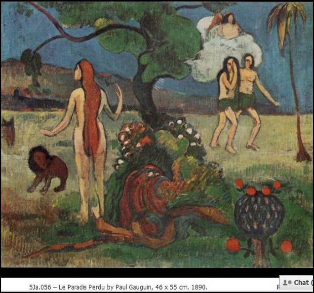
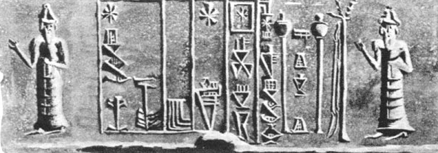
Anu
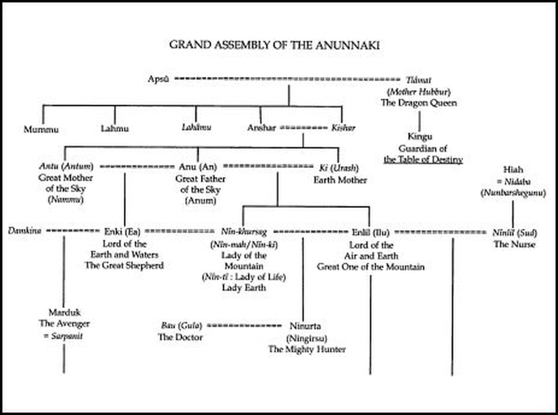
Adapa, son of Ea and Sumerian king of Eridu, was regarded as the first
man and sage, but was not considered immortal. Whereas Adam is claimed
to have named the beasts and fowl, the Akkadian myth credits Adapa with
the invention of speech. On a fishing expedition in the Persian Gulf the
south wind buffeted him but the strength of his curse broke its wings.
Afterwards he was summoned to heaven by Anu who was displeased by his
action. Before he left Ea dressed his son in sackcloth and told him not
to partake of any food that he was offered while there. Greeted by
Tammuz (see Ishtar), Adapa informed the dying king that he mourned his
absence from earth, a sentiment that was well received. His frank
admission of guilt greatly appeased Anu who offered him the "food of
life" and the "water of life," of which Adapa refused and returned to
Eridu. Another legend tells of his wrath for Ea, Adapa like Adam
discovered his father's advice was intended to deny him immortality. He
suffered the same consequence as Adam by learning that henceforth
disease and death became the fate of humankind.
Lilith
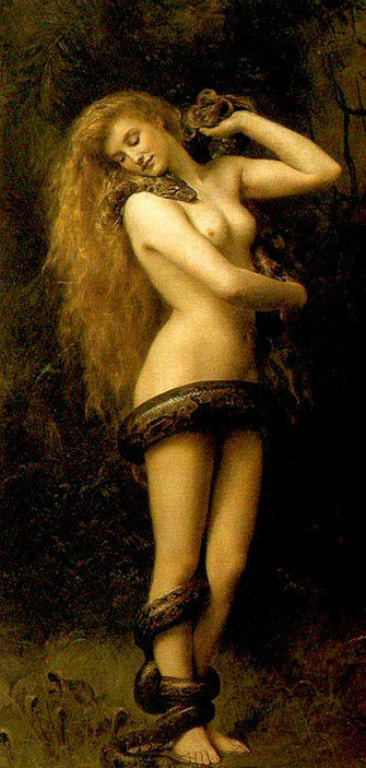
The bloodline of Lilith and Samael, the pure royal blood of true kingship descended from Transylvania to Mesopotamia, through the Sobekh queens of Egypt, to the Tuatha de Danaa, the Pictish Dragon Fairy Princesses of the Holy Grail in Anjou and Caledonia.
According to ancient tradition red hair and pale white skin is the royal holy colouring. Lilith, the goddess-mother of the Elves was red haired. Radamanthus, the brother of Enlil (Zeus Dispater) was red haired. The vampires of Serbia were red haired. The Scythians and Tocharians were red haired and witches the world over were recognised by their red hair and green eyes.
Consequently red hair, white skin and green eyes are the racial colouring of the Elven God Kings. This colouring, determined by the possession of the MC1R genes, is not human in the accepted sense; it is Neanderthal and, just as biblical and Sumerian histories tell us of the hybridisation of Man and the Gods, so Man and Neanderthal interbred.
Genetically humanity and its bottleneck of restricted genes is only about 100,000 years old, whereas the MC1R genes are over 400,000 years old. So the most distinctive racial gene of the Elves of history proves that they came from non-human parents, just as the myths and legends said they did. We can therefore use the MC1R genes as one set of reliable markers for those of the Dragon race. The Neanderthal origins of MC1R were confirmed by research completed by geneticists working under Dr. Ros Harding at Oxford University who kindly passed a summary of the results to me.
In order to reinforce the racial marker provided by the MC1R genes and refine the distinction between human and Dragon blood, we may additionally ascertain race by the genetic footprint left by the most commonly known ancient cultural practice of the Elves; that of vampirism and the ingestion of human material.
The Neanderthal are thought to have ingested human blood and tissue. Hebrew tradition tells us that the Naphidem - the sons of the Dragon Nephilim and the daughters of man - preyed on mortals for food. Later, right up until the medieval period and beyond, the elves and the vampires were synonymous and so the imbibing of human material, by an over-race descending from the Nephilim and the Neanderthal, is a commonly documented facet of Fairy Dragon Culture. And guess what! It has indeed left a genetic imprint.
The most common problem with ingesting human material is the risk of Creuzfeld Jakob´s Disease; the human form of Mad Cow´s Disease. If the material is only ingested occasionally the risk of infection is slight and the chance of building up a genetically inherited resistance to the disease is nil.
Genetic footprints takes thousands of years of consistent practice to build and develop and so in order to have within one´s makeup the Variant Creuzfeld Jakob´s Disease Resistant Gene or vCJDr, one´s ancestors must have been consistently and principally vampires and cannibals, as were the Dragons or Faeries over millenia. The vCJDr genetic survey was conducted by a team headed by Prof. John Collinge at the Institute of Neurological Science at London University and the Human Ingestion conclusion was theirs.
So, as a belt and braces technique to reduce the risk of selecting people with only insignificant genetic markers, it is blindingly obvious that to choose the most pure blooded descendants of the elves we are going to have to ensure that both MC1R and vCJDr genes are present in both parental lines.
The Watchers, Nephilim, Elves, the Anunnaki, all the ancient
gods, etc, originated from the "Dragon Kings", a race of god-kings
that flourished in the regions of Scythia. Almost all of these serpent
deities are associated with rain and thunder, or waterways.
The whole of Scotland, from Loch Ness to the river Tweed, contains tales of noble women impregnated by horned serpents while swimming in the waters. These tales are also told in Gaul of the lineage of the Merovingian kings, whose founder, Merovee, was born from his mother's encounter with a Quinotaur, a "Four Horned" water serpent. Indeed, some version of the horned serpent, whose origin and meaning are never satisfactorily explained, can be found throughout world mythology.
Some suggest the Sumerian Ningiszida, a horned serpent who guarded the tree of life and the gateway to the underworld, was the forerunner of the Biblical serpent and the prototype of the rest, Marija Gimbutas of UCLA proposed this in her monumental work on European pre-history,The Civilization of the Goddess: The World of Old Europe, suggest the Brythonic ram-horned serpent of Cernunnos and the Lithuanian Zilvine, the King of Serpents who made the mortal Egle his queen, may be much the older - may in fact go back to the end of the last ice age.
The Horned Serpent is a persona of the god Cernunnos, the Brythonic Horned God who was associated with the hunt and fertility. As I said in that other post, it was probably his worship at Loch Ness that was reported in Columba's famous meeting with the Loch Ness Monster. The pagan ancestors of the Merovingians were also most likely worshipers of Cernunnos. The tale that he had two fathers, one a Quinotaur, probably indicates that Merovee was conceived during the fertility rites associated with Cernunnos and has no connection with Christ nor Mary Magdalene. Cernunnos was the lord of life, death and the underworld. He was also the Sun God and the ritual of the Sacred Hunt, where the mortal king was the sacrifice, sheds more light on the Merovingians' pagan roots. The last Merovingian king, Dagobert, was slain in just such a manner at the winter solstice.
In the Americas, the horned serpent, like the the Choktaw deity Sint holo, was the giver of inspiration, a promethian spirit who introduced agriculture, language, and other gifts of knowledge to mankind. The Tewa deity Avanyu was the feathered sky serpent of the Pueblos (Zuni, Kolowisi, and Hopi, Paluluka), a rain and lightning deity who was believed to have given birth to the waterways, and whose voice was thunder. Algonquin pictographs commonly depict a horned, feathered serpent known as Mishipizheu and similar icons are scattered across North America.
The best known feathered serpent of the Americas is, of course, the Aztec Quetzalcoatl, (Mayan Kukulkan, Incan Urcaguey) who was exiled by the gods for his gifts of knowledge to the Aztec people. Quetzalcoatl was described as a bearded white man and legends persist that he was a prince of the Brythonic people, though, like the Merovingian Quinotaur, there have been attempts to also connect Quetzalcoatl with Christ.
